Search
Geographical maps (specialist)
Tübinger Atlas des Vorderen Orients. Karten zu Teil B (Geschichte) komplett
72.0 x 50.0 cm, sheet map, flat
2100,00 €
Tübinger Atlas des Vorderen Orients. Karten zu Teil A (Geographie) komplett
72.0 x 50.0 cm, sheet map, flat
1450,00 €
Tübinger Atlas des Vorderen Orients, Komplettes Kartenwerk (Teil A+B)
72.0 x 50.0 cm, sheet map, flat
3550,00 €
Editor: Kopp, Horst; Röllig, Wolfgang
Tübinger Atlas des Vorderen Orients
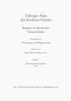
Register zu den Karten / General Index
17.0 x 24.0 cm, 1944 p., paperback / softback
248,00 €
No english description available. Showing german description:
Europa auf dem Weg nach Asien - mit dieser Umkehrung eines bekannten Slogans kann man die heutige Situation...
Subseries: Karten
Rebstock, Ulrich; Gaube, Heinz; Ilisch, Lutz
The Umayyad Empire
B VII 4 Das Umayyadenreich. B VII 5 Die Abbasiden und die Lokaldynastien um das Jahr 1000 n.Chr.
72.0 x 50.0 cm, 1 p., sheet map, flat
15,00 €
Denk, Wolfgang
Levant. Relief, Hydrology and Settlements
72.0 x 50.0 cm, 1 p., sheet map, flat
15,00 €
Gamer-Wallert, Ingrid
Egypt in the end of the epoch (21st to so-called 31st dynasty)
72.0 x 50.0 cm, 1 p., sheet map, flat
15,00 €
Pirker, Siegfried; Timm, Stefan
Middle East. Christianity from the 8th to the 14th Century
72.0 x 50.0 cm, 1 p., sheet map, flat
15,00 €
Denk, Wolfgang; Müller, Günter
Egypt. Relief, Hydrology and Settlements
72.0 x 50.0 cm, 1 p., sheet map, flat
15,00 €
Schweizer, Günther; Rinnebach, Stephan; Müller, Günter
Middle East. Relief, Hydrology and Settlements.
72.0 x 50.0 cm, 1 p., sheet map, flat
15,00 €
Finkbeiner, Uwe; Pongratz-Leisten, Beate
Examples of Ancient Near-Eastern Cities. Babylon during the Neo-Babylonian Empire
72.0 x 50.0 cm, 1 p., sheet map, flat
15,00 €
Jericke, Detlef; Schmitt, Götz
Palestine in the Late Roman-Byzantine Period (ca. 300-640 A.D.)
72.0 x 50.0 cm, 1 p., sheet map, flat
15,00 €
Halm, Heinz; Riplinger, Thomas; Thorau, Peter
Eastern Mediterranean Area 1204-1291
B VIII 6 Östlicher Mittelmeerraum 1204 bis 1291. 1 : 4 Mio. B VIII 7 Westliches Kleinasien. Byzantiner und Türkmenen 1291 bis 1337. 1 : 2 Mio.
72.0 x 50.0 cm, 1 p., sheet map, flat
15,00 €
Finkbeiner, Uwe; Pongratz-Leisten, Beate; McGinnis, John; Stronach, David; Dittmann, Reinhard
Examples of Ancient Near-Eastern Cities. Residences of the Assyrian empire
B IV 20.1.1 Ninua (Ninive). B IV 20.1.2 Ninua (Ninive)/Kuyuncik. B IV 20.2.1 Kalhu (Nimrod). B IV 20.2.2 Kalhu (Nimrod), Detail. B IV 20.3.1 Kar Tukulti-Ninurta (Tulul al-Aqr). B IV 20.3.2 Kar Tukulti-Ninurta (Tulul al-Aqr), Detail. B IV 20.4.1 Dur Sarruken (Hursabad). B IV 20.4.2 Dur Sarruken (Hursabad), Detail
72.0 x 50.0 cm, 1 p., sheet map, flat
15,00 €
Jericke, Detlef; Schmitt, Götz
Palestine in the Late Roman-Byzantine Period (ca. 300-640 A.D.)
72.0 x 50.0 cm, 1 p., sheet map, flat
15,00 €
Müller, Günter; Denk, Wolfgang
Central and Southern Arabia. Relief, Hydrology and Settlements
72.0 x 50.0 cm, 1 p., sheet map, flat
15,00 €
Wittke, Anne-Maria; Prayon, Friedhelm; Röllig, Wolfgang; Bredow, Iris von
Eastern Mediterranean and Mesopotamia around 700 B.C.
72.0 x 50.0 cm, 1 p., sheet map, flat
15,00 €





 Neuerscheinungen 2023/2024
 Gesamtverzeichnis 2023/2024
 Katalog Oriental Studies & Linguistics
 Mittelalter
 Deutsche Inschriften
 Musiktherapie
 Literaturen im Kontext