Search
Historical geography
Heinen, Heinz
Egypt during the Hellenistic-Roman Period
72.0 x 50.0 cm, 1 p., sheet map, flat
15,00 €
Gaube, Heinz; Klein, Rüdiger
Examples of Islamic Cities
*Safavid Isfahan/Esfahan
72.0 x 50.0 cm, 1 p., sheet map, flat
15,00 €
Rebstock, Ulrich
The Islamic Empire under the Fist four Caliphs (632-661 A.D./11-40h)
72.0 x 50.0 cm, 1 p., sheet map, flat
15,00 €
Krawulsky, Dorothea
The Middle East 736-850/1336-1447 A.D.
The Timur Empire under Saroh (807-850h/1405-1447 A.D.)
72.0 x 50.0 cm, 1 p., sheet map, flat
15,00 €
Rebstock, Ulrich
The Islamic Empire under *Abdalmalik (685-705 A.D./66-85h)
The Consolidation of the Umayyad Empire
72.0 x 50.0 cm, 1 p., sheet map, flat
15,00 €
Tomsky, Jan
Lower and Middle Palaeolithic. Examples
Nahr al-Kabir Valley (Syria)
72.0 x 50.0 cm, 1 p., sheet map, flat
15,00 €
Hewsen, Robert H.
Armenia and Georgia. Christianity in the Middle Ages (7th-15th Century)
72.0 x 50.0 cm, 1 p., sheet map, flat
15,00 €
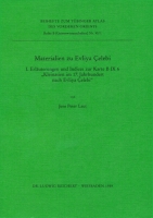
Laut, Jens Peter
Materialien zu Evliya Celebi I.
Erläuterungen und Indices zur Karte B IX 6 »Kleinasien im 17. Jahrhundert nach Evliya Celebi«
17.0 x 24.0 cm, 248 p., paperback / softback
32,00 €
No english description available. Showing german description:
Das zehnbändige „Fahrtenbuch“ (Seyahatname) des Evliya Celebi (ca. 1611-1687) ist eine der wichtigsten...
Series: Tübinger Atlas des Vorderen Orients (TAVO)
Number: 90 Volume: 1
Subseries: Reihe B (Geisteswissenschaften)
Finkbeiner, Uwe; Röllig, Wolfgang
Mesopotamia. Early Dynastic Period
72.0 x 50.0 cm, 1 p., sheet map, flat
15,00 €
Schmitt, Götz; Wagner, Jörg; Rademacher, Rochus
Palestine under Roman Predominance
Herod the Great and the Procurators (40 B.C.-70 A.D.)
72.0 x 50.0 cm, 1 p., sheet map, flat
15,00 €
Allen, Terry; Gaube, Heinz
Examples of Islamic Cities
Timurid Herat. Villages, Sites and Buildings Preserved or of Probable Identification
72.0 x 50.0 cm, 1 p., sheet map, flat
15,00 €
Gebel, Hans-Georg
South-East Arabia. Prehistoric Settlements
Stone-Ange of the Oman Peninsula. Early-Bronze Age of the Oman Peninsula
72.0 x 50.0 cm, 1 p., sheet map, flat
15,00 €
Hewsen, Robert H.
Armenia and Georgia in the 10th and 11th Centuries
72.0 x 50.0 cm, 1 p., sheet map, flat
15,00 €
Uerpmann, Hans-Peter; Hannß, Christian; Frey, Wolfgang; Kürschner, Harald
Late Hunters and Gatherers of the Middle East. Examples of the Ecological Setting of Sites. Stone Age Settlements on the Coast of Ra's al-Hamra' (Masqat/Oman)
Topography and Ecology. Geomorphology. Present Natural Vegetation.
72.0 x 50.0 cm, 1 p., sheet map, flat
15,00 €
Naumann, Claudia; Kühn, Hans-Joachim; Klemm, Verena
Asia Minor. The Expansion of the Byzantine Empire in the 10th and 11th Century
B VII 18 Kleinasien. Die Erweiterung des Byzantinischen Reiches im 10. und 11. Jahrhundert. B VII 19 Das Byzantinische Reich, die Salguqen und Kreuzfahrer (1081 bis 1204)
72.0 x 50.0 cm, 1 p., sheet map, flat
15,00 €
Pill-Rademacher, Irene
Middle East. Romans and Parthians (14-138 A.D.)
72.0 x 50.0 cm, 1 p., sheet map, flat
15,00 €
Gaube, Heinz; Leisten, Thomas
The Central Regions of the 'Abbasid Empire in the 10th Century A.D.
72.0 x 50.0 cm, 1 p., sheet map, flat
15,00 €





 Neuerscheinungen 2023/2024
 Gesamtverzeichnis 2023/2024
 Katalog Oriental Studies & Linguistics
 Mittelalter
 Deutsche Inschriften
 Musiktherapie
 Literaturen im Kontext