Search
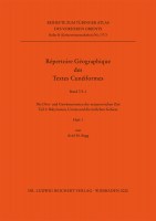
Die Orts- und Gewässernamen der neuassyrischen Zeit
Teil 3
2020
17.0 x 24.0 cm, 1104 p., maps, paperback / softback, in 2 Bänden
ISBN: 9783954904303
17.0 x 24.0 cm, 1104 p., maps, paperback / softback, in 2 Bänden
148,00 €
ISBN: 9783954904303
Short Description
Historical geography is one of the most important disciplines which allow a reconstruction of the history of the Ancient Near East. There are principally the cuneiform sources which open the access to the numerously attested geographical names. The present volumes are the third and last part of the Neo-Assyrian toponyms for the series Répertoire Géographique des Textes Cunéiformes (RGTC 7). The first part was published by the author in 2007 and dealt with the Levant (RGTC 7/1). The Second part RGTC 7/2 (2017) covers Egypt, the Arabian peninsula, the Assyrian heartland, the Transtigridean region, the Northern Jezireh, the Habur-Basin, the Eastern Jezireh, and Northern Mesopotamia. RGTC 7/3 comprises approx. 1400 toponyms and further 500 fragmentary place names from the Eastern regions of the Assyrian empire, Urarṭu, and Babylonia. Furthermore, places of unknown location were also included. As in the first two volumes, RGTC 7/3 has detailed registers as well as two appendices with additions and corrections to RGTC 7/1 and RGTC 7/2.Description
Historical geography is one of the most important disciplines which allow a reconstruction of the history of the Ancient Near East. There are principally the cuneiform sources which open the access to the numerously attested geographical names. The toponyms from these sources were collected and commented in the series Répertoire Géographique des Textes Cunéiformes (RGTC) published in the frame of the Tübinger Atlas des Vorderen Orients (TAVO). Sixteen volumes already published in this series have become together with the corresponding TAVO-historical maps an important research tool in the field of the historical geography of the Ancient Near East.The present volumes are the third and last part of the Neo-Assyrian toponyms for the series Répertoire Géographique des Textes Cunéiformes (RGTC 7). The first part was published by the author in 2007 and dealt with the Levant (RGTC 7/1). The Second part RGTC 7/2 (2017) covers Egypt, the Arabian peninsula, the Assyrian heartland, the Transtigridean region, the Northern Jezireh, the Habur-Basin, the Eastern Jezireh, and Northern Mesopotamia. RGTC 7/3 comprises approx. 1400 toponyms and further 500 fragmentary place names from the Eastern regions of the Assyrian empire, Urarṭu, and Babylonia. Furthermore, places of unknown location were also included. As in the first two volumes, RGTC 7/3 has detailed registers as well as two appendices with additions and corrections to RGTC 7/1 and RGTC 7/2.The arrangement of the book follows the earlier volumes of the series. RGTC 7 comprises all the published, non-literary sources from the Neo-Assyrian period, namely royal inscriptions, letters, legal and administrative texts, treaties, royal grant and decrees, astrological reports, and historiographical texts. Following Kh. Nashef’s RGTC 5 (1982), all the texts after 934 BCE have been considered. The alphabetically arranged collection of place names is divided as usual in the categories “place names” and “watercourses”. The main criterion for the arrangement of the attestations are the different spellings. Within the same spelling the arrangement of the attestations follows chronological and typological criteria. The attestations are followed by a commentary concerning the identification of the place name with a discussion of the relevant secondary literature. As in the volumes RGTC 8 and RGTC 12/2, the toponyms are ordered according to their linguistic provenance. Comprehensive indices, among them a register of modern place names as well as a register of the mentioned Old-Aramaic, Biblical, and Classical toponyms among others complete the books. Enclosed maps show most of the identified places.


 Preface

 Neuerscheinungen 2023/2024
 Gesamtverzeichnis 2023/2024
 Katalog Oriental Studies & Linguistics
 Mittelalter
 Deutsche Inschriften
 Musiktherapie
 Literaturen im Kontext